
I found a building that looked like 109 in Shibuya! I thought, and upon closer review, I found that the number was 119 and it was the West Fire Station of the Ichikawa City Fire Department.
Nijyuku
Today, I will walk along the Narita Kaido Road from the Mito Kaido Road.

Aoto Station
I got off the train at Aoto station (Aoto means blue whetstone).
It’s near a prefecture without stones (Chiba Prefecture), but they were digging up whetstones! I looked it up and found out that the station is named after a person. I was a little disappointed.

Keisei Nakagawa Bridge and Takasago Bridge
I go out to the Nakagawa River first. The Keisei Nakagawa Bridge looks like a stylish cable-stayed bridge, but in fact you can see the Takasago Bridge beyond it.

Collaboration of stone chair and wooden chair
As I walked upstream, I saw a collaboration of stone and wooden chairs at the corner of the Jikei Medical University Katsushika Medical Center. I don’t know if they were planning to collaborate from the beginning or if the space between the stone chairs was too wide, so they filled in the gaps with wooden chairs, but it was a neat design. I wonder if it is because it is a hospital that it is heart-shaped when viewed from the side?

Nakagawa-Nijuku Water Pipe Bridge, Tokyo Metropolitan Government Bureau of Waterworks
There were water pipes sticking out from both banks. I wondered if they were building an aqueduct, and when I got closer, I found that the pipes were beautiful, but the concrete supporting them was very old. It looks like the pipes have already been used and the center part has been cut out to allow ships to pass through.
As proof of this, there was an old plaque that said, “Nakagawa-Shinjuku Water Pipe Bridge, Bureau of Waterworks, Tokyo Metropolitan Government, completed in March 1963, produced by Mitsubishi Nippon Heavy Industries, Ltd. and Yokohama Shipyard.”
There was a time when Mitsubishi Heavy Industries had the word “Japan” in its name.
The reason for not removing the aqueduct completely is probably that they are thinking of reusing it in case there is a water shortage due to an earthquake or something.

Equipment of unknown use
I don’t understand the purpose of this equipment. Why is it set up on a tripod? Why is it being built underwater and the only contact point with the water is a scaffold? Why is there a blowhole attached to it? I really don’t know. It’s a mystery.

Wood pile in Nakagawa
I often see wooden stakes standing in the river.
I wonder if this is to prevent the banks from becoming thin. But in some places, they are dredging, aren’t they? Is it possible to know the appropriate method of flood control for a particular place by looking at it?

Nakagawa Bridge
While I was thinking about this, I arrived at the Nakagawa Bridge. The Mito Kaido passes over this bridge.

Second-generation Nakagawa Bridge’s main pillar and flag-raising area
Crossing the bridge to the left bank, there is a small plaza. There were a few things that were a bit unusual. First, there is a pillar of the Nakagawa Bridge.
The current Nakagawa Bridge is the third generation, built in 1993 (Heisei 5). So this must be the second generation of the pillar, built in 1933.
Next to the main pillar is a sign that says “National Flag Hanging Place. It was built in October 1933. In other words, the Nakagawa Bridge and the flag-raising site were built at the same time.

Machilus
Next is machilus.
I had never heard of it before.
It says that the hollow of the tree here was a machilus that was used as a signpost at the east bridge.
The tree on the left is a sapling grown from the machilus.

The junction of Mito Kaido and Narita Kaido
I came to the junction of Mito Kaido and Narita Kaido.
I took a few pictures, but I just couldn’t get them to turn out the way I wanted.
The Mito Kaido extends from the road on the left where the truck is, turning left to the other side, and the Narita Kaido begins in the front right direction after crossing the crosswalk.

The Narita Road continues from the junction
The Narita Road leading from the junction is so wide.
There are hardly any cars on it. It’s a road that gives you a strange feeling when you walk along it.

Shinkin freight line
About 1.5 km from the junction, the road suddenly narrows and I cross the tracks of the Shinkin freight line.
It looks like it could be converted into a double track passenger line at any time, but it is being operated as a single track freight line.

Keisei Kanamachi Line
This time I crossed the Keisei Kanamachi Line.
The “nari” in Keisei is the “nari” in Narita, so it is closely related to the Narita Highway, making this a memorable first contact. The Keisei Line is a standard gauge line, so the track width is wider than the Shinkin freight line.

Shinsui Sakura Kaido
I found Shinsui Sakura Kaido! The word “Sakura” is written in hiragana, which is a combination of Sakura Kaido (Narita Kaido) and Sakura (cherry blossom) Kaido.
The waterway of Shinsui Sakura Kaido was built by Mr. Ishii Zenbei in the Meiji era (1868-1912), and the source of water is said to be the Edo River.
Edogawa river bank
I could see the bank of the Edogawa River. The weather is really nice and hot today.

Machilus
Hmm? What’s this tree?
Yes, it’s a machilus. So, maybe I’ve been seeing machilus all the time. I guess I didn’t recognize it.

Signpost at the front of the cafe
I found a signpost in front of an ordinary cafe.
The bottom of the middle of the left sign seems to be the word “michi(road)”. Also, the sign on the right looks like “hidari(left)? michi(road)”? If I could read these characters, it would make my walks more enjoyable.

Kitano Shrine
Kitano Shrine was located right after passing through the Keisei railroad tracks. I think it’s unusual to have another torii gate right behind the first one. However, there was no explanation about the torii on the sign.
Instead, there was a description of Chi-no-wa-kuguri (cogon grass ring), which is designated as an intangible folk cultural asset by the local government. Susanoo-no-Mikoto is also enshrined as a deity, and today is June 30, the very day of the summer purification ceremony!
But the cogon grass ring was nowhere to be seen, as the shrine’s annual festival is held on June 25.

Ichikawa Bridge
I cross the Edogawa River at Ichikawa Bridge.
I tried to find the border between Tokyo and Chiba Prefecture on the bridge, but couldn’t find it.
Ichikawa-juku

Ruins of the Ichikawa barrier
As I entered Chiba Prefecture, I saw an arrow pointing to the ruins of the Ichikawa barrier. I followed it and found a stone monument to the ruins of the Ichikawa barrier about 100 meters to my left. According to the signboard, as might be expected, there were strict controls on guns entering and women leaving the barrier.
From here, I walked along Route 14.

Ichikawa Hirokoji
The first signal was Ichikawa Hirokoji. It seems that it was not set up to stop fires from spreading, just because it was a wide alley. It just happened to be a wide road.

Ichikawa City Fire Bureau West Fire Station
What? I thought it was 109, just like Shibuya, but when I took a closer look, it was 119. It was the West Fire Station of the Ichikawa City Fire Department. It’s a cool design.

Pedestrian bridge across the Outer Ring Road
I was able to take a picture that looks like a vision of the future. This is a newly built pedestrian bridge. I felt like I was getting a little something out of it. The location of the pedestrian bridge is on the Tokyo Gaikan Expressway. This route was just opened to traffic on June 2 of this year, so it’s very new and fresh.

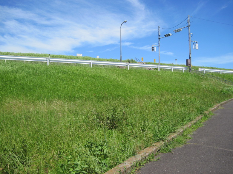
Tokyo Gaikan Expressway slightly visible behind the wall
Yawata-juku

Torii Gate of Katsushika Hachimangu Shrine
I found the torii gate of Katsushika Hachimangu Shrine! There was a banner saying “Nagoshi-no-oharae,” so there must be a cogon grass ring. However, it seemed a bit far from here to the shrine, so I excused myself.
Across Route 14, on the other side of the torii gate, there is an area densely covered with bamboo and trees.

Shirazu-Yawata-no-Mori (Yawata-no-Yabu-Shirazu)
This is Shirazu-Yawata-no-Mori, also known as Yawata-no-Yabu-Shirazu. It is said to be a place where one should not enter, and once you enter, you cannot come out.
No one knows why they are forbidden to enter.

Shimosa-Nakayama Station
I arrived at Shimosa-Nakayama Station, my goal for the day.
I guess the reason for the massive clock tower is because there is a Hokkekoji temple nearby.
Anyway, it was another hot and thirsty day.
Walking data
Course: Keisei Main Line Aoto Station -> Narita Road -> JR Sobu Line Shimosa-Nakayama Station
Distance: 14.8km
Time: 3h50m
Water: 1 liter of sparkling water

