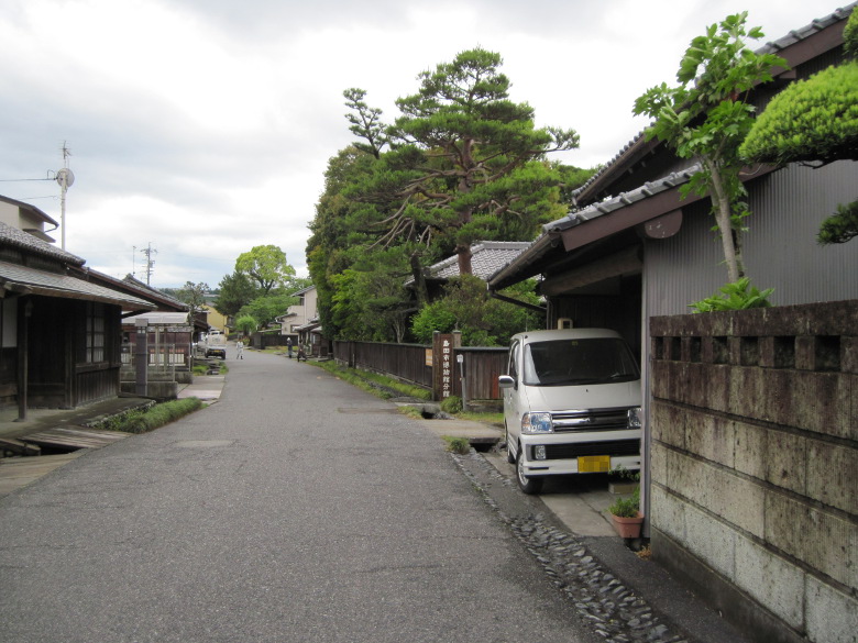
Fujieda-juku
It started pouring in the morning. It took me a little while to prepare for the rain with a raincoat and a sack cover, and I had to leave after 6:00.
When I tried to go left from the Ogawa Hotel and return to the Tokaido Highway, my handy GPS showed the opposite direction. I thought it was strange and turned it back on, but the same result. After thinking it over, I realized that I was the one who was wrong, and the right was the correct answer. Yesterday, I walked past the hotel from Tokaido to Fujieda Station and was told about the hotel there, so I thought Tokaido was in the direction of Fujieda Station. I’m glad I had my GPS with me.

Signboard in front of Sawayaka Housing Co.
After a short walk, I found a sign titled “For those traveling on the Tokaido Highway” in front of Sawayaka Housing Corporation. It said that we were free to use the benches and restrooms. I passed by, feeling pleased with the thoughtfulness.
About 40 minutes after my departure, I saw a signboard for Sengan Zutsumi, a designated cultural property of Fujieda City. It is said that there is a large embankment built in 1635 by a man named Tadayoshi Kenmotsu, who invested 1,000 kan to prevent the Oi River from flooding. I had to take a detour to see it.
However, even when I came to a place that looked like it, at first I couldn’t figure out where the embankment was.

Sengan Zutsumi and Seto Someii Tradition Museum
After going back and forth a few times, I found out that the slightly higher part of the building where the Sengan Zutsumi and Seto Someii Tradition Museum stands was probably the Sengan Zutsumi. I felt sorry for Mizuno Kemotsu Tadayoshi, who invested a thousand kan but only a little remains now.

Kamiaojima Icirizuka
After 7:00, I found the remains of Kamiaojima Icirizuka (51 ri).
Shimada-juku

Shimada-juku Ichirizuka
I found the remains of Shimada-juku Ichirizuka (52 ri) a little after 8:00 a.m. It’s a good pace, almost an hour per ri.

Shimada manhole cover
I think many people who walk the streets enjoy the design of manhole covers. The design of the Shimada manhole was a picture of a woman on a lotus stand crossing the Oi River.
Near the Oigawa Kawagoe Site
The area around the Oigawa Kawagoe Ruins has a charming atmosphere with its old houses.

Kawagoe Worker’s Doll
In one of the buildings, there was a Kawagoe Ninsoku doll. Most of the dolls and paintings of Kawagoe Ninsoku and Hikyaku are dressed very lightly, almost naked. This is fine in summer, but were they also dressed like this in winter?

Oi River
Looking over the Oi River from the top of the embankment. With the construction of this embankment, the Sengan-zutsumi, which we saw earlier, has finished its role.
I pause for a moment to think about the scenes of transportation in the past. At the end of the Edo period, the number of Kawagoe people in Shimada and Kanaya was over 650 each, so this area must have been very crowded.
To our delight, the rain stopped.

Oigawa Bridge
I cross the 1026.4 meter long Oigawa Bridge. “This is the river where the song goes, “You can cross the 8 ri of Hakone with a horse, but you can’t cross the Oigawa River even if you want to (if the weather is bad and the water is too high). Today, it can be crossed no matter what the weather is like.
Kanaya-juku

Kanaya ichirizuka
A little after 10:00, I found the remains of Kanaya ichirizuka (53 ri). It took me two hours to get there from Shimada-juku Ichirizuka Ruins. This is because I slowed down a bit at the Oigawa River and took the long way around by going through the Oigawa Bridge instead of crossing the river directly.
From the Ichirizuka in Kanaya, the road goes up through the railroad tracks.
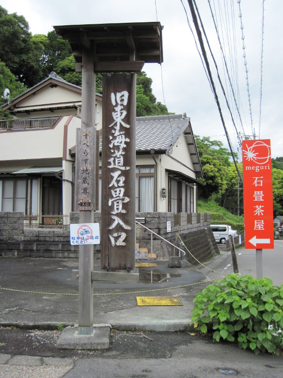
Signboard at the entrance to the stone pavement
I found a sign for the entrance to the stone pavement. I was worried because the path looked difficult to find when I did my preliminary research. A sign like this is a big help.

Kanayazaka Stone Pavement Ascent
The stone pavement starts here. What makes it a little different from Hakone is that there are many different kinds of stones mixed in. But the damage to your feet is the same.
Nissaka-juku

Saya no Nakayama
I descended the cobblestones of Kikugawazaka and climbed up again to find Saya no Nakayama! This is a difficult place that is called along with Hakone and Suzuka Pass. But it’s a beautiful view with tea fields spreading out.

Sayoshika Ichirizuka
I found Sayoshika Ichirizuka. Originally, it is located at about 54 ri. However, there is no such mound at 54 or 55 ri, and for some reason it is considered the 56th ri.
After noon, I descended the steep slope of Nissaka.

Remains of the Night Crying Stone
I found the remains of the famous Night Crying Stone. The stone is said to be placed at Kyuenji Temple, just before Ichirizuka, but I passed it by without knowing.

Dategata Ichirizuka

Kuzukawa Ichirizuka
We found Dategata Ichirizuka (57 ri) and Kuzukawa Ichirizuka (58 ri). The pace is exactly one ri per hour.
Kakegawa-juku

Seventh bend
I came to the seventh bend of Kakegawa around 2:30. I had to turn at a very ordinary crossroad, so I ended up going too far. Once again, I was glad I had my handy GPS with me.
I bought some green tea melon bread at a bakery called Kakegawa Andersen. It was an anpan of green beans with a slight scent of green tea. I couldn’t drink kuzu-yu, a specialty of Kakegawa, because the store I was looking for was closed.

Kurama River.
At around 3:30, I crossed the Kurama River. It is said that the river is called Futase River because it crosses two rivers. I think Hiroshige’s painting of Kakegawa is a scene of this area.
Fukuroi-juku

Tokaido Domannaka Tea House

Wooden and Kettle
A little before 6:00, I arrived at the teahouse in the very center of Fukuroijuku. Fukuroi is the 27th inn on the Tokaido Highway, counting from both Edo and Kyoto, and is in the center of the highway. There was a tree and a kettle, just like Hiroshige’s painting of Fukuroi. There were no people in sight.

Family Lodge Hatago-ya Fukuroi
I searched for lodgings around the area with my cell phone and decided on Family Lodge Hatago-ya Fukuroi as the place to stay today. It was hard to get to, being 1km away from the Tokaido Highway. However, it had only been built two months ago, so it was spotless.
Walking data
Course: Fujieda-juku -> Shimada-juku -> Kanaya-juku -> Nisaka-juku -> Kakegawa-juku -> Fukuroi-juku
Distance: 42.9km
Time: 12h25m


コメント